Master's Thesis | Media Design
Infomaps
Data visualization methods for information design on maps
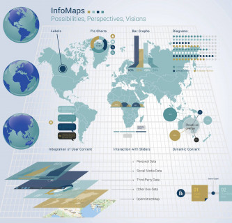
How can you project exciting information graphics directly onto maps using the Semantic Web? It does not matter whether it is economic, political, demographic or ecological data. The linking of diagrams with geodata results in great advantages, because they can be received more quickly, easily and directly.
Maps offer a multitude of ways in which to present data, facts and information. Especially if the maps are already digitized and vectorized, as for example in OpenStreetMap or other providers, and the data is available on the World Wide Web, information can be displayed directly on the map and supplemented with additional layers.